도입이 처음이신가요?
ORBRO 전문가가 직접 상황을 분석하고
최적의 솔루션을 제안해드립니다.


Integrated Urban Disaster Information and Real-time Visualization
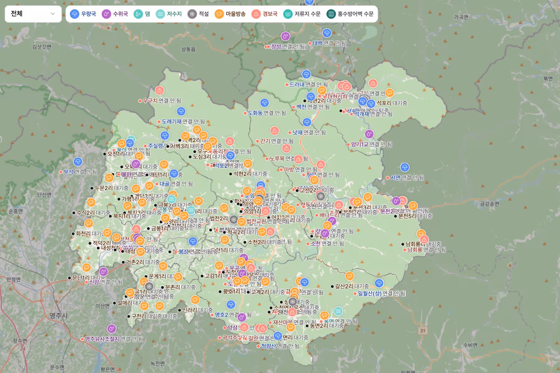
Integrated Monitoring Based on Urban Infrastructure
Manage various city infrastructure data required for disaster response on a single platform. Integrate road, river, facility, and sensor data to check risk factors across the entire city in real-time.
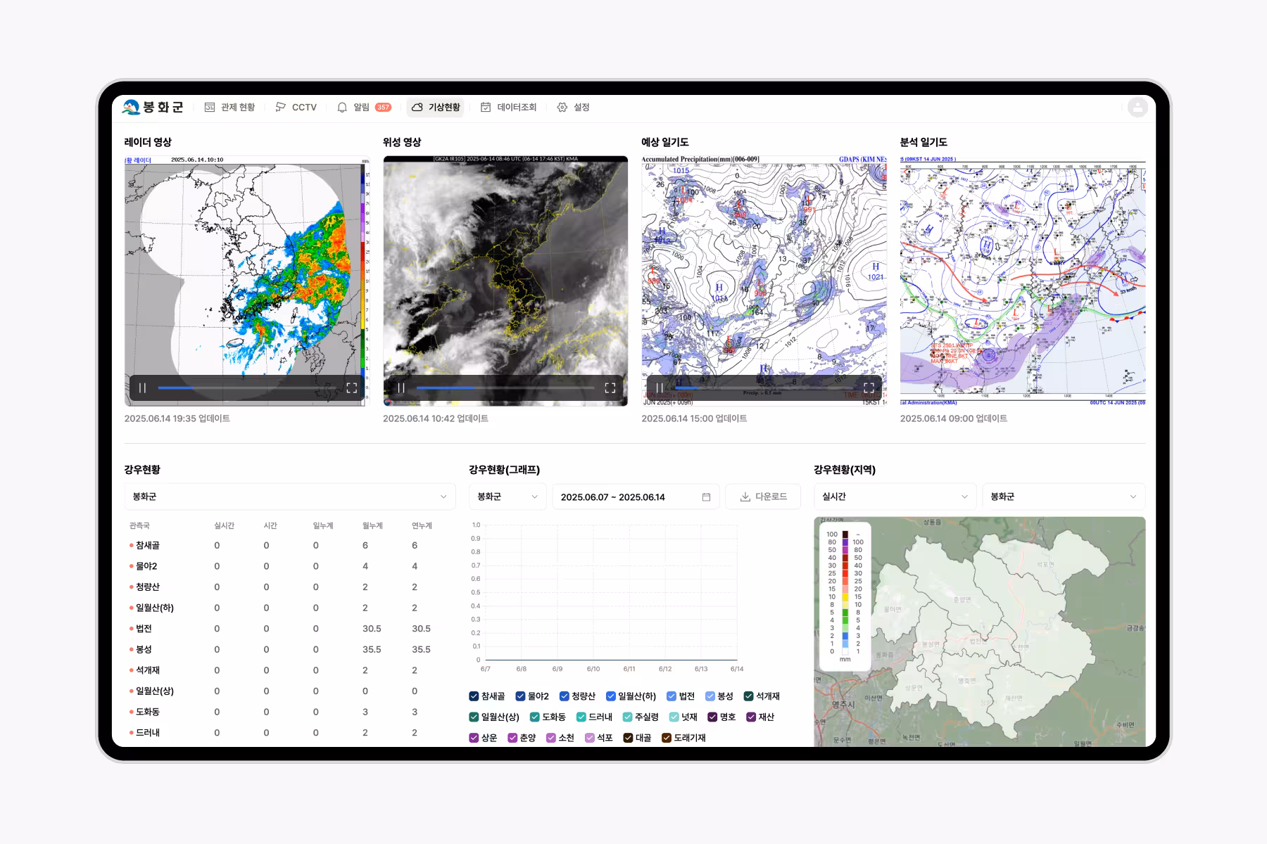
Real-time Weather Data Collection and Analysis
Collect satellite images, weather charts, and radar data in real-time, providing predictive and alert systems for severe weather. Quantify the city’s weather environment for scenario-based response plans.

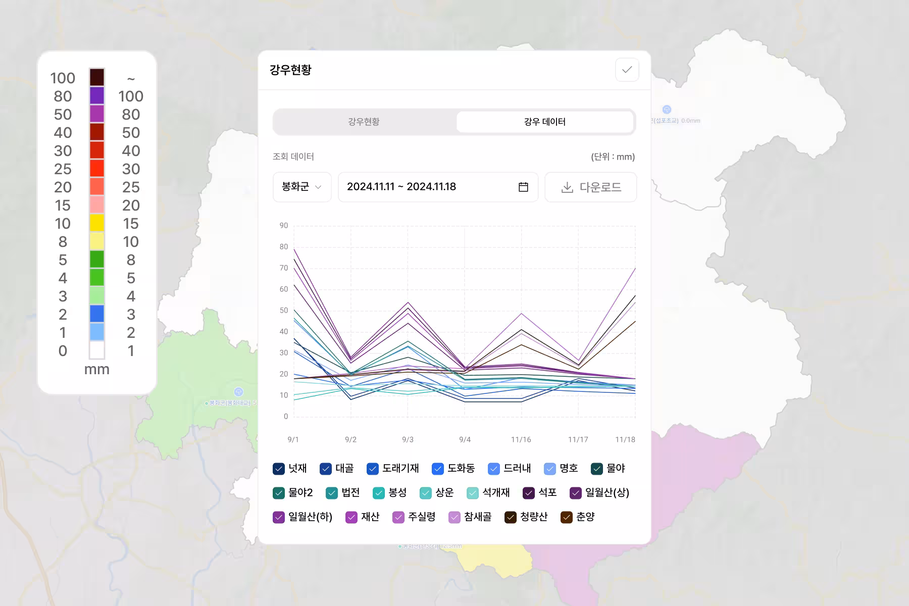
Check Regional Rainfall Status in Real-time
Collect and analyze rainfall data for each area in real-time using installed rain gauges. Prioritize response to affected areas during heavy rain.
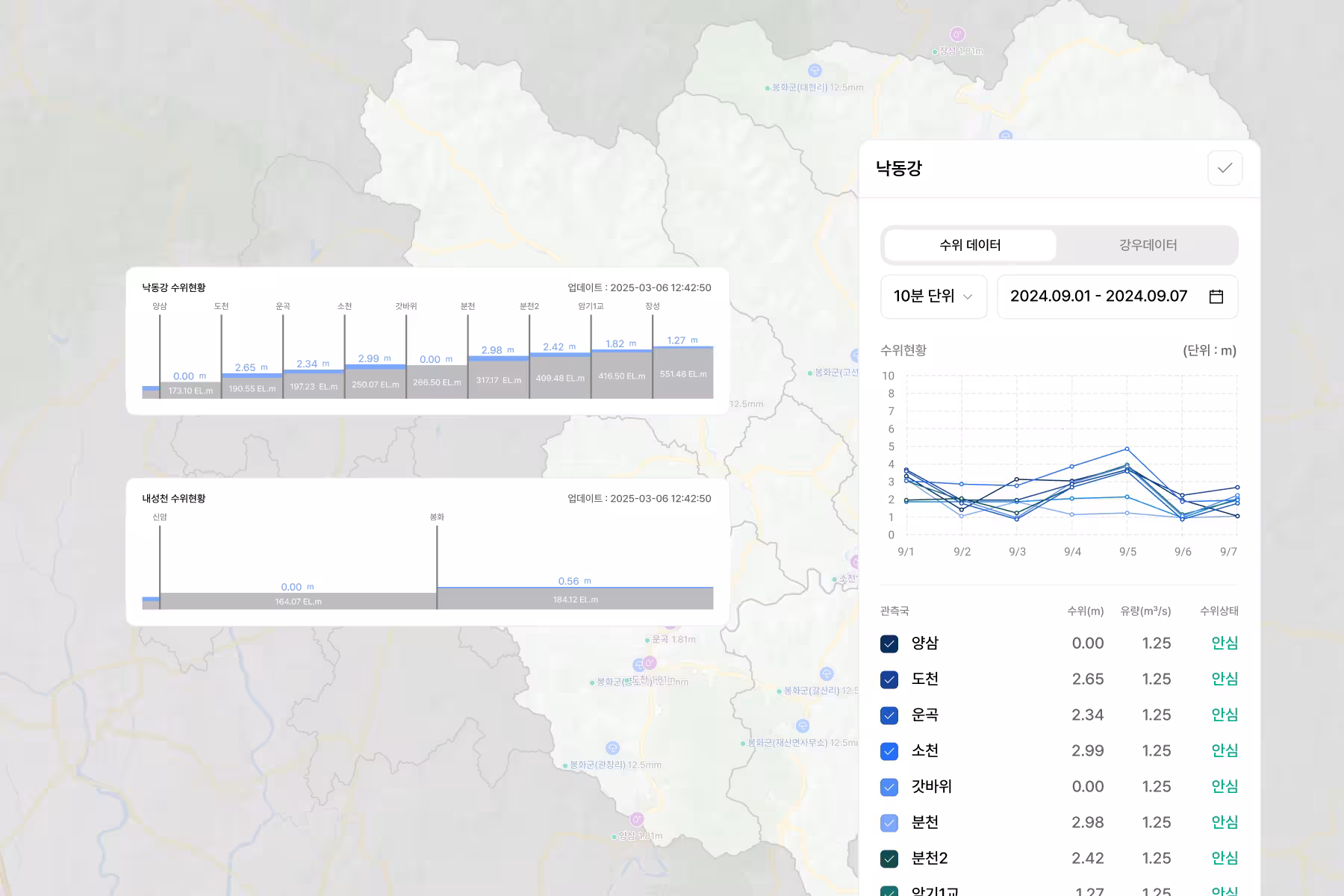
Visualize River Water Level and Flow Status
Visualize the water level, flow, and gate status of major rivers like the Nakdong River and Naeseongcheon in real-time. Automatically detect abnormal levels and send risk alerts.
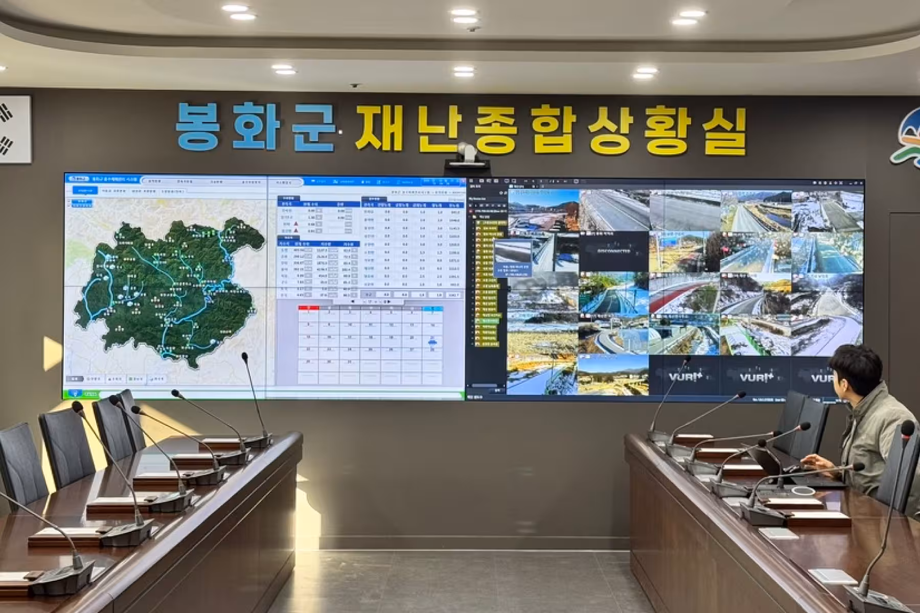
Disaster Response Automation and Control Room Utilization
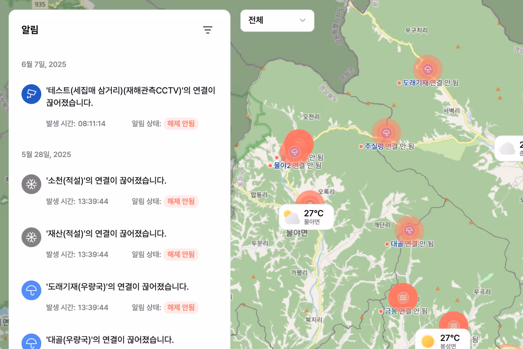
Alarm Integration Based on Comprehensive Situations
Aggregate various data and display risks clearly on the control room screens. Automatically execute customized alerts and response triggers based on situation-specific decision criteria.
Control Room Display Configuration and Real-time Display
In the disaster control room, CCTV, alert history, and major river water levels are displayed on large screens for real-time monitoring. The dedicated layout enhances on-site responsiveness and allows quick sharing of the overall disaster status.
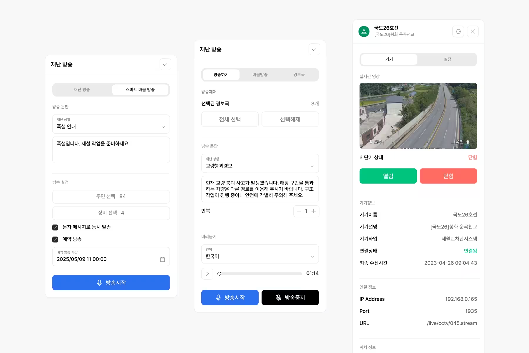
Remote Response System During Disasters
In the event of a disaster, immediate actions can be taken remotely such as broadcasting village alerts via TTS, sending SMS, monitoring CCTV footage, and controlling remote circuit breakers.
Multi-panel Data Visualization
Provides a data panel integrating weather information, water level, rainfall, and alert indicators. Compare and judge various environmental information intuitively on a single screen, accelerating situational awareness and decision-making.
Various Features

Manage roads, rivers in one place.

Radar & satellite shown live.

Auto analyze rain by area.
Track river level & flow live.
Show CCTV & sensors together.

Split screens for each purpose.

Send alarms when rules met.

View CCTV & control devices.

Auto run scenario plans.

Save all history by default.
권장 제품
UWB Enterprise Kit

Industry IoT
Comfort Kit