If you have ever used GPS navigation in a downtown canyon of high-rises, you know the scene: the blue dot suddenly jumps to the next block. The GPS signal has bounced off buildings and blurred the position. But the part worth noticing is something else. The app knows that coordinate looks wrong — and it draws it anyway, without a moment of doubt. That is because a coordinate carries no tag saying how far this value can be trusted.
In industrial location tracking, this problem goes beyond inconvenience and becomes a safety issue. In this final installment of The Science of Accuracy, we look at how to attach confidence grades to coordinates.
Ⅰ. Not All Coordinates Are Created Equal
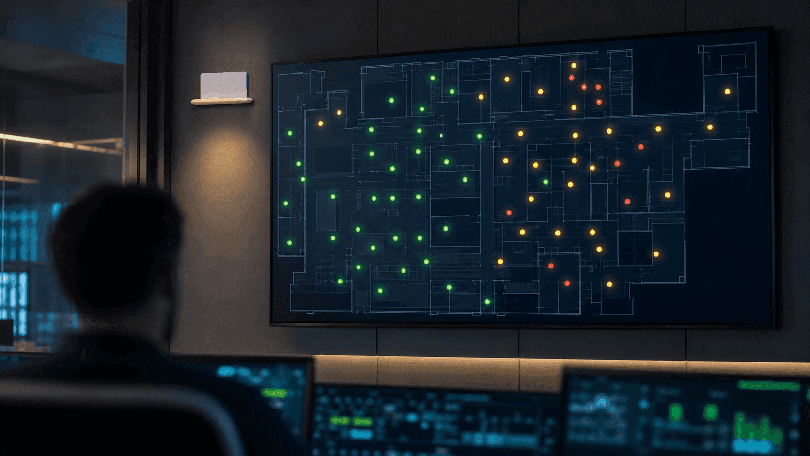
Each dot on a monitoring screen is, in truth, of uneven quality. Some coordinates were computed from clean signals in a zone with good geometry; others were barely pieced together in a corner, fighting through echoes and blockage. Yet many systems draw both as the same dot. Whether the consumer is a safety alert or a movement analysis, the downstream side never learns the quality.
The final piece of a good positioning system is not accurate computation but honest reporting. It must be able to tell confident coordinates apart from uncertain ones.
Ⅱ. Three Checks — Geometry, Time, Physics
ORBRO's positioning architecture does not publish a computed coordinate right away; it first runs three checks. A medical checkup is a helpful analogy.
- Geometric consistency — Was the geometry of the anchor combination that produced this coordinate within the zone's usual baseline? (This is the GDOP story from the previous installment.)
- Temporal continuity — Does it follow naturally from the previous coordinate? If a person teleported to the opposite end of the site in 0.1 seconds, that is not a coordinate — it is an error.
- Physical plausibility — Is the speed and motion something a person or piece of equipment could actually produce? A path that passes through a wall deserves suspicion.
Depending on how it fares in these three checks, each coordinate receives one of five grades.
Ⅲ. Five Confidence Grades — Read Them Like a Traffic Light
The five grades read just like a traffic light.
- Qualified (green) — Passed all three checks. A coordinate you can use immediately for critical tasks such as safety alerts and control.
- Low-Confidence (light green) — Passed the checks, but borderline signals were detected. Perfectly adequate for monitoring and analytics.
- Ambiguous (yellow) — The geometry is good, but multiple position candidates are competing. Instead of picking hastily, the system waits for the next observation to decide.
- Deferred (amber) — Briefly outside the baseline, or physical plausibility is borderline. Output is held back for a moment.
- Invalid (red) — Failed the checks. Not drawn on screen — blocked, but kept on record.
The key is the existence of Ambiguous. Conventional systems, when faced with two position candidates, arbitrarily pick one and draw it — just as the navigation app draws the drifted coordinate anyway. Admitting you do not know and waiting a beat is better than confidently giving the wrong answer.
Ⅳ. How Not to Cry Wolf — The Economics of False Alarms
The greatest enemy of a safety alert system is the false alarm. If a hazardous-zone entry alert fires wrongly ten times a day, the eleventh — real — alarm gets ignored. The boy who cried wolf, replayed on an industrial site. A large share of false alarms trace back to low-quality coordinates flowing into alert logic without validation.
With confidence grades, the solution becomes simple. Safety alerts fire only on Qualified coordinates. Statistical uses such as movement analysis and dwell-time statistics include Low-Confidence coordinates as well, to enlarge the sample. Each use case accepts a different quality bar. This is how you reduce false alarms without giving up on your data.
Ⅴ. Even Discarded Coordinates Do Work
One last piece. Coordinates blocked as Invalid are not thrown away; they remain on record. If Invalid keeps recurring in a particular zone, that zone is a weak spot that needs reinforced anchor placement or an improved environment. Just as accumulated checkup records become the grounds for changing one's habits, the record of failed positioning becomes a map for site improvement. The positioning system ends up reporting its own weaknesses and proposing improvements — a self-correcting loop.
In Closing — Accuracy Is an Operating Discipline, Not a Number
To sum up the four installments: positioning accuracy is decided by the site itself (Part 1); GDOP is the ruler that measures that influence (Part 2); pooling many signals into a statistical consensus makes the result robust (Part 3); and only when the output carries confidence grades does it become a system you can actually operate (Part 4). The "accuracy: X cm" line in a catalog fails to capture even the first of these pieces.
ORBRO has pursued this discipline long enough to publish the entire framework as a technical white paper. If false safety alarms are troubling your site, or you are evaluating a location-based safety system you can trust, contact ORBRO.