Indoor Positioning and Digital Twin Monitoring: Why ORBRO Builds Everything in One Place
2026-08-27
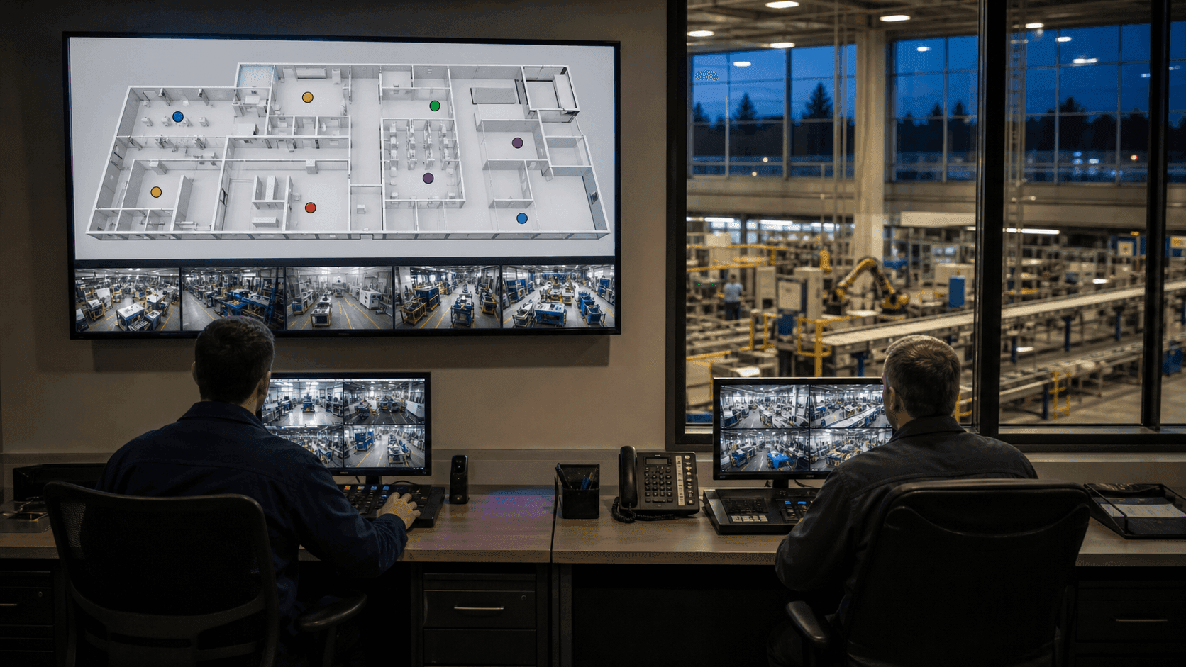
Suppose a forklift disappears from the monitoring screen. Four things could have happened: the tag stopped, an anchor got blocked, the positioning engine discarded the signal, or the screen simply stopped drawing the coordinate. How quickly a vendor can tell you which of these four doors to open first says more about them than any specification sheet.
When you start evaluating indoor positioning, you generally meet three kinds of vendors. Importers of overseas solutions offer proven technology, but changing anything for your site means waiting on a headquarters schedule in another time zone. Software-only vendors show polished screens, but the tags and anchors belong to someone else, so when positioning wavers, their reach ends at the screen. System integrators assemble products from several makers into the picture you asked for, but when something breaks, the first task is figuring out whose layer broke.
All three structures look identical while everything works. The difference appears when the site defies expectations. And in location tracking, a site that defies expectations is not the exception: it is the default.
This article explains why ORBRO builds everything itself, from tags and anchors to edge servers and monitoring software, and what that choice changes on a real site.
I. Where Assembled Systems Get Stuck
A configuration stitched together from several companies runs into trouble at two points.
The first is a fault that cannot be narrowed down. A symptom like the vanishing forklift can originate in the tag, the anchor layout, the positioning engine, or the screen. When each layer belongs to a different company, their logs cannot be compared, and each company gives the same answer: our layer is fine. The site manager's first job becomes getting three companies into one room, and the symptom continues while they compare calendars.
The second is the range that can be adjusted for the site. In a warehouse full of metal stock, signals bounce and coordinates jump, and no screen setting can fix that. What needs adjusting is which signals the positioning algorithm trusts and which it discards, and that judgment is locked inside the firmware of equipment someone else built.
Both problems share one root: the people who can fix it and the place that needs fixing belong to different companies. That is why ORBRO chose not to split these layers.
II. What ORBRO Builds
| Layer | What it covers |
|---|---|
| Sensors and devices | UWB tags and anchors, badge-type devices, BLE and GPS/LTE tags, sensor devices |
| Edge | Computing servers placed on site: video AI analysis and positioning computed locally |
| Positioning engine | Signal quality grading, coordinate calculation, zone determination |
| Monitoring software | ORBRO OS: real-time monitoring on floor plans, zones and alerts, event records, external system integration |
Building all four layers in one place means that when something goes wrong, one team can decide internally which layer to touch. Changing a tag's transmission interval, changing the engine's judgment rules, and changing the screen's interpolation are options inside the same team. Instead of three companies gathering over one vanishing forklift, one team walks the stack from top to bottom.
A fair objection follows: doesn't one company building everything mean being locked into that company? The boundary stays open for exactly that reason. ORBRO OS exports location data and events through standard interfaces such as REST and MQTT, so everything you accumulate can flow into your MES or WMS at any time. What stays in one place is not your data. It is the responsibility: the responsibility to chase a problem all the way to its root.
III. Four Things That Change on Site
1. Hardware adjusts to site conditions
Some sites cannot use standard products: a tag that must sit directly on metal, a shape dictated by safety rules, or an environment too harsh for a common battery setup. With mechanical design and manufacturing in-house, these become requests that can be answered. You cannot ask a screen company to change the shape of a tag.
2. Data does not have to leave the site
Location data carries worker movements and production information. A structure that only works through an external cloud lengthens security reviews, and monitoring stops when the link drops. ORBRO processes positioning and video analysis on edge devices at the site, supporting a configuration that is complete without an external network. The advantages of this structure are covered in the edge and on-premise monitoring article.
3. Mixed positioning methods, one screen
Even within one site, each zone needs a different precision. The shipping dock needs slot-level accuracy, the wider yard is fine with zone-level, and objects that cannot carry tags must be captured by camera. Merging UWB, BLE, GPS/LTE, and AI camera recognition on the same floor plan is what ORBRO OS does. Mix the methods: the operator still watches one screen.
4. Scaling keeps the same configuration
The anchors, tags, and screens from your pilot expand as they are during full rollout. Because nothing needs replacing midway, the pilot investment never becomes a sunk cost. What to verify beforehand is laid out in the PoC design article.
These four share one trait: none of them can be confirmed in a demo. Their value appears only after the site moves differently from the plan.
IV. How ORBRO Treats Accuracy
The most common misconception in location tracking is that accuracy is fixed by a single hardware spec. In reality, the geometry of the anchors around a tag changes the result dramatically with the very same equipment. A lopsided layout amplifies error; an even surround produces a more accurate coordinate from the same signals.
ORBRO handles this principle at the design stage. We set anchor geometry from the floor plan, grade how trustworthy each signal is, and show that grade on screen. Just as a weather forecast pairs temperature with the chance of rain, each coordinate comes with a confidence grade. On a real site, whether you can trust a coordinate is needed more often than the coordinate itself. The underlying principles are covered in the GDOP article and the position confidence grades article.
V. Where It Fits, and Where It Is Too Much
To be honest, not every site needs real-time location tracking.
If recording the fact that assets passed a fixed gate is enough, RFID is more economical. The same goes for sites where matching stock counts is all that matters and individual positions are unnecessary. The differences are laid out in the RTLS vs RFID article.
On the other hand, it is worth evaluating if any of the following apply.
- Assets move freely without fixed routes
- Required precision differs by zone
- Location data must not leave the site
- Integration with existing MES, WMS, or attendance systems is required
- The plan is to start with a pilot and scale in stages
VI. Considerations Before Adopting
- Prepare floor plans and site conditions first: configuration and cost start here. What to prepare is summarized in the quote request guide.
- Divide zones by required precision: covering everything at maximum precision is unnecessary, and the division alone changes the cost substantially.
- Verify in a pilot zone first: include the hardest conditions so the pilot represents the full rollout.
- Fix the integration scope early: design is not finished until you know which events go to which fields of which system.
Closing
Choosing a vendor is ultimately choosing who can fix how much when the site defies expectations. While everything works, every proposal looks alike and every demo runs smoothly.
ORBRO builds the tags, anchors, edge servers, positioning engine, and monitoring software itself. When a forklift disappears from the screen, one team walks the four possibilities from top to bottom and, when needed, fixes that layer. Send us your floor plan and site conditions, and we will map out a zone-by-zone design and a staged rollout plan.
Recommended Blogs

Forklifts Queue at Dispatch. Look at Dwell Time.
2026-10-08

Found the Medical Equipment. Is It Ready to Use?
2026-10-07

Your Factory Layout Changed. Did Your RTLS Map?
2026-10-06

Contractor Safety Management, How to Record When Contract Workers Arrived and Where They Worked
2026-10-02